The good people that ran the shop fed us even though they knew we had no money with us. We had canceled our debit cards when they disappeared into the Saranac in my ammo can a month before, and when they resurfaced a week later it was too late. We got as much cash as we could and got back on the trail. I've already put a check in the mail for them, but still, the generosity we meet is impressive.
As we sat and ate, we could hear some of the locals in the next room talking about the school in Allagash. The town has long depended on the logging industry, but in the last decade or two has accelerated into depression as the demand for pulp wood in Maine has declined. They were talking about how the elementary school in town had too few kids and could not afford to stay open. The only resort, one person said, was that they bus the kids to Fort Kent. That is over 30 miles away, and violates a federal statute, apparently, that says children can't be bused that far from home. Here is a shot of the decaying Allagash High School, long since abandoned due to lack for students and taken over by the public library, municipal offices, town government, fire department, etc.

One of the many people I contacted before our trip began was Ethan Miller, Bates class of 2000. He had received an Otis Fellowship just the same as us, and he and a friend walked across the Northern Forest. His insights into what we were to expect on our exploration were invaluable and shockingly apt. I mention him here because he wrote a great song about Allagash Village, among other things. You can - and should - go to his website and download the song and buy his albums:
http://www.riotfolk.org/member.php?id=8
After lunch, we entered the St. John River and busted out the last 30 miles or so into Fort Kent. The river was very wide at this point in its run towards the Bay of Fundy, as it peaks in the spring and then quickly diminishes in size during the month of June as it has no real headwater lakes as does the Allagash. We crusied down river-wide Class II rapids between long, wide cobble banks, all the while noticing the tremendous damage the ice had done to the shore line. The banks were steep and exposed and they showed huge trees snapped off and sheared naked of their bark. In most areas giant piles of snow still lay, remnants of huge quantities of ice that scour this drainage annually.
Our route description said our take out - and the eastern terminus of the trail - was a half mile after the confluence of the St. John and the Fish River, so we paddled on for a while before realizing that the park where the trail ended was actually right next to the mouth of the Fish River. We finished the Northern Forest Canoe Trail by paddling upstream against a heavy current. It some how seemed fitting.

Covering a bit under 105 miles in 32 hours felt a kin to jogging through an art museum, especially as it was the Allagash that we were flying down. Ben and I had gotten up to pace such that we felt restless if we were not moving all day, and going slower than we knew we could go felt almost painful. In any case, two 50-mile days had Plan B pulling into Fort Kent in the late afternoon on Thursday May 31st, 2007.
We had named the boat that we borrowed from the Bates Outing Club 'Plan B'; fitting, we thought, as our plan A, the Penobscot 186, had been broken by the Saranac. The replacement for that big beautiful black boat, now shattered, was an ancient red Old Town Tripper. Ben took her from the racks we had built on Frye Street in Lewiston, and shuttled her down as we got ready to return to the trail in early May. She creaked and groaned so loudly we could not talk to each other our first few days, that changed only after we tightened up all her bolts, stripped as they were. Both bow and stern were completely scraped down to the bare ABS substrate; the vinyl was peeling back in a multitude of colors. Every few days we would have to scrape her wounds out and cover them with duct tape. Hence, Plan B.
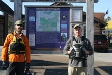
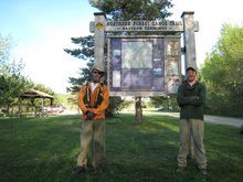
There was no one there to greet us, no flags waving or anything, but we were just as happy that there weren't. We came ashore, found the NFCT sign (just to make sure), and shook hands, grinning like idiots. We were done.
Map

Mileage
This tally includes the milage for Vermont, Quebec, New Hampshire, and Maine only, as all of my notes before Plattsburgh, NY were lost in the Saranac River. Day 7 began at the Rip Van Winkle Motel in Plattsburgh, NY.
Day 7 - 22 miles to Stephanson Point, VT
Day 8 - 22 miles to East Highgate, VT
Day 9 - 14 miles to Lussier Campsite, VT
Day 10 - 5 miles to Enosburg Falls, VT
Day 11 - 16 miles to Richford, VT
Day 12 - 16 miles to Highwater, QC
Day 13 - 24 miles to Newport, VT
Day 14 - 9 miles to West Charleston, VT
Day 15 - 21 miles to Island Pond, VT
Day 16 - 16 miles to Nulhegan Campsite, VT
Day 17 - 25 miles to Groveton, NH
Day 18 - 13 miles to West Milan, NH
Day 19 - 22 miles to Errol, NH
Day 20 - 15 miles Richardson Lake, ME
Day 21 - 24 miles to Rangeley Lake, ME
Day 22 - 11 miles to Rt. 16 Bridge over S. Br. Dead River, ME
Day 23 - 24 miles to Flagstaff Lake near Stratton, ME
Day 24 - 25 miles to Grand Falls of Dead River, ME
Day 25 - 11 miles to Spencer Lake, ME
Day 26 - 38 miles to Long Pond, ME (assisted)
Day 27 - 23 miles to Kineo, Moosehead Lake, ME
Day 28 - 33 miles to Little Ragmuff Stream, W. Br. Penobscot River, ME
Day 29 - 23 miles to Ellis Brook, Chamberlain Lake, ME
Day 30 - 20 miles to Churchill Dam, Churchill Lake, ME
Day 31 - 53 miles to Ramsay Ledges, Allagash River, ME
Day 32 - 51 miles to Fort Kent, ME
We packed up our kit and portaged through town to a motel for the night. Ben's dad was already on his way to pick us up, but the nine hour drive does not really lend itself to just turning around and doing it twice in one day. For much of the trip, I had always gotten a kick out of the looks we always got when we were portaging in a place where no one really had any business portaging. Fort Kent was no exception. As we made our way through town, we stopped to ask for directions to the motel, and as we did we asked where the best bar in town was. The answer was that the only bar in town was right next to the motel. Donezo.
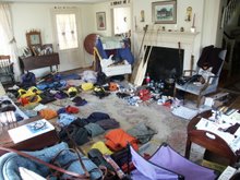
That was about five days ago now. The tents have been hung up and washed, the boat returned to its rack, the packs and barrel scrubbed. The satellite phone has been mailed back, with a note requesting our money back, as the one time we used it, to call Ben's parents and let them know when we were coming in, the phone did not and could not get a signal. Our safety net had been imaginary. We came to the end of our food with one and a half meals to spare, and with plenty of stove fuel left over. No broken gear, not a single torn map, and a med kit that had never been needed, not even for a scratch.
A man by the name of Bradford Washburn died this past January. He had done expeditions all over the world, many of them funded by National Geographic, but all starting with a solo climb of Mount Washington at the age of 11. He also founded the Boston Museum of Science and told Amelia Earhart to get a better radio before her tragic flight (she did not listen). Washburn once said: "Failure is always crowned by success- if you persist." His life surely proved that to be true time and again, and so to now do ours. We suffered a tremendous failure in New York, one that could very easily have taken more than just my lucky waterbottle and an old dry-bag.
But we persisted, and we now wear the mantle of success. It took us 32 days - not 33 as I had reported earlier - to cross the Northern Forest by canoe. The route has been done in 55 days, 50 days, and 45 days by three seperate groups, or so I have been able to gather from a variety of newspaper and magazine articles. That means we did it twelve days faster than anyone has ever done it before, and we set something of a record. The record matters little in the grand scheme of things though, it does not mean we worked all that much harder or suffered more than any one else that has done the route. Seeing as how we both made it through without a single black fly bite and less than half a dozen mosquito bites, I dare say we may have suffered less than them.
We started during ice-out and ended just at the start of black fly season, getting ourselves mixed up in a bit more of the former than of the latter. Despite all the rain, freezing cold weather, and swollen rivers we encountered, this may be the optimum season for hitting the trail as a thru-paddler. We managed over one hundred and fifty miles upstream and several hundred miles of downstream on big, swift rivers and tiny, shallow brooks, a shade under eighty-five miles of portaging, and the difference in a few hundred miles on lakes and ponds of all sizes and descriptions. We made about one million paddle strokes between the two of us.
I'd like to thank everyone who had a hand in this trip, and there were alot of you. My family, of course, for all of their words of encouragement and notes throughout the trip, to my parents for driving us up there and all of their love and support, to my cousin Chris for always giving me someone to look up to and for all his help in getting our gear picked out, purchased, and squared away. To Ben's parents for their love and support, and for the phenomenal amount of driving they did to get us to and from the trail. To all the wonderful people we met along the way who helped us out so much and in so many ways, even opening their homes to us as the Browns, the O'Donnels, the Wymans, and the O'Neils did. Your generosity and hospitality kept our spirits high and will not soon be forgotten. To all of my dear friends that called and wrote when we dumped and after, your concern touched me deeply. To my bowman Ben, I actually could not have done it without you, and hope you feel the same about me. Your a total brah. To the people we may never see again, to Porky and to Charlie and all the rest who offered rides and who were so willing to talk about the land and the forest they live and work in, and to especially to our friend on North Hero: you are our hero.
Whats next? In the short term, its fresh salad, barbequed steak, a pint of Dogfish Head 90-minute Imperial India Pale Ale, and maybe some Dairy Queen and my second hot shower of the day. In a few days I head back to Grand Lake Stream, ME and Darrow Camp to take children into the bush for the summer, maybe on a 42-day trip to Canada, maybe on two 21-day trips in Maine. Ben will go up to Camp Winona in Bridgton, ME to head up their whitewater kayaking program and generally enjoy Winona's hundreth anniversary.
In the long term, who knows; these expeditions have a nasty side effect that I am only now coming to terms with:
they're habit forming.
Thanks again to all that listened.
Sincerely,
Zand B. Martin


