Monday, June 4, 2007

The End

We only stayed one night on the Allagash, at Ramsay Ledges just south of the Michaud Farms ranger station. The Allagash was a bit shallower than I remembered it, but all the same it carried us along to the confluence with the St. John River at Allagash Village. We made the hike up to Two Rivers Lunch, and ate ourselves two meals each under the gaze of the few dozen animals stuffed and mounted around us. I remembered stopping there at the end of my Allagash trip with Chewonki, and had been telling Ben for a few weeks that we would have to stop there. Here is one of Ben's shots of the place:


The good people that ran the shop fed us even though they knew we had no money with us. We had canceled our debit cards when they disappeared into the Saranac in my ammo can a month before, and when they resurfaced a week later it was too late. We got as much cash as we could and got back on the trail. I've already put a check in the mail for them, but still, the generosity we meet is impressive.

As we sat and ate, we could hear some of the locals in the next room talking about the school in Allagash. The town has long depended on the logging industry, but in the last decade or two has accelerated into depression as the demand for pulp wood in Maine has declined. They were talking about how the elementary school in town had too few kids and could not afford to stay open. The only resort, one person said, was that they bus the kids to Fort Kent. That is over 30 miles away, and violates a federal statute, apparently, that says children can't be bused that far from home. Here is a shot of the decaying Allagash High School, long since abandoned due to lack for students and taken over by the public library, municipal offices, town government, fire department, etc.


One of the many people I contacted before our trip began was Ethan Miller, Bates class of 2000. He had received an Otis Fellowship just the same as us, and he and a friend walked across the Northern Forest. His insights into what we were to expect on our exploration were invaluable and shockingly apt. I mention him here because he wrote a great song about Allagash Village, among other things. You can - and should - go to his website and download the song and buy his albums:
http://www.riotfolk.org/member.php?id=8

After lunch, we entered the St. John River and busted out the last 30 miles or so into Fort Kent. The river was very wide at this point in its run towards the Bay of Fundy, as it peaks in the spring and then quickly diminishes in size during the month of June as it has no real headwater lakes as does the Allagash. We crusied down river-wide Class II rapids between long, wide cobble banks, all the while noticing the tremendous damage the ice had done to the shore line. The banks were steep and exposed and they showed huge trees snapped off and sheared naked of their bark. In most areas giant piles of snow still lay, remnants of huge quantities of ice that scour this drainage annually.

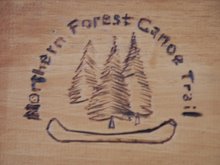
Our route description said our take out - and the eastern terminus of the trail - was a half mile after the confluence of the St. John and the Fish River, so we paddled on for a while before realizing that the park where the trail ended was actually right next to the mouth of the Fish River. We finished the Northern Forest Canoe Trail by paddling upstream against a heavy current. It some how seemed fitting.


Covering a bit under 105 miles in 32 hours felt a kin to jogging through an art museum, especially as it was the Allagash that we were flying down. Ben and I had gotten up to pace such that we felt restless if we were not moving all day, and going slower than we knew we could go felt almost painful. In any case, two 50-mile days had Plan B pulling into Fort Kent in the late afternoon on Thursday May 31st, 2007.

We had named the boat that we borrowed from the Bates Outing Club 'Plan B'; fitting, we thought, as our plan A, the Penobscot 186, had been broken by the Saranac. The replacement for that big beautiful black boat, now shattered, was an ancient red Old Town Tripper. Ben took her from the racks we had built on Frye Street in Lewiston, and shuttled her down as we got ready to return to the trail in early May. She creaked and groaned so loudly we could not talk to each other our first few days, that changed only after we tightened up all her bolts, stripped as they were. Both bow and stern were completely scraped down to the bare ABS substrate; the vinyl was peeling back in a multitude of colors. Every few days we would have to scrape her wounds out and cover them with duct tape. Hence, Plan B.

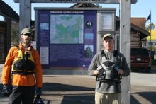
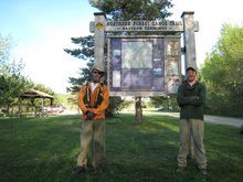
There was no one there to greet us, no flags waving or anything, but we were just as happy that there weren't. We came ashore, found the NFCT sign (just to make sure), and shook hands, grinning like idiots. We were done.

Map


Mileage

This tally includes the milage for Vermont, Quebec, New Hampshire, and Maine only, as all of my notes before Plattsburgh, NY were lost in the Saranac River. Day 7 began at the Rip Van Winkle Motel in Plattsburgh, NY.

Day 7 - 22 miles to Stephanson Point, VT
Day 8 - 22 miles to East Highgate, VT
Day 9 - 14 miles to Lussier Campsite, VT
Day 10 - 5 miles to Enosburg Falls, VT
Day 11 - 16 miles to Richford, VT
Day 12 - 16 miles to Highwater, QC
Day 13 - 24 miles to Newport, VT
Day 14 - 9 miles to West Charleston, VT
Day 15 - 21 miles to Island Pond, VT
Day 16 - 16 miles to Nulhegan Campsite, VT
Day 17 - 25 miles to Groveton, NH
Day 18 - 13 miles to West Milan, NH
Day 19 - 22 miles to Errol, NH
Day 20 - 15 miles Richardson Lake, ME
Day 21 - 24 miles to Rangeley Lake, ME
Day 22 - 11 miles to Rt. 16 Bridge over S. Br. Dead River, ME
Day 23 - 24 miles to Flagstaff Lake near Stratton, ME
Day 24 - 25 miles to Grand Falls of Dead River, ME
Day 25 - 11 miles to Spencer Lake, ME
Day 26 - 38 miles to Long Pond, ME (assisted)
Day 27 - 23 miles to Kineo, Moosehead Lake, ME
Day 28 - 33 miles to Little Ragmuff Stream, W. Br. Penobscot River, ME
Day 29 - 23 miles to Ellis Brook, Chamberlain Lake, ME
Day 30 - 20 miles to Churchill Dam, Churchill Lake, ME
Day 31 - 53 miles to Ramsay Ledges, Allagash River, ME
Day 32 - 51 miles to Fort Kent, ME

We packed up our kit and portaged through town to a motel for the night. Ben's dad was already on his way to pick us up, but the nine hour drive does not really lend itself to just turning around and doing it twice in one day. For much of the trip, I had always gotten a kick out of the looks we always got when we were portaging in a place where no one really had any business portaging. Fort Kent was no exception. As we made our way through town, we stopped to ask for directions to the motel, and as we did we asked where the best bar in town was. The answer was that the only bar in town was right next to the motel. Donezo.

That was about five days ago now. The tents have been hung up and washed, the boat returned to its rack, the packs and barrel scrubbed. The satellite phone has been mailed back, with a note requesting our money back, as the one time we used it, to call Ben's parents and let them know when we were coming in, the phone did not and could not get a signal. Our safety net had been imaginary. We came to the end of our food with one and a half meals to spare, and with plenty of stove fuel left over. No broken gear, not a single torn map, and a med kit that had never been needed, not even for a scratch.

A man by the name of Bradford Washburn died this past January. He had done expeditions all over the world, many of them funded by National Geographic, but all starting with a solo climb of Mount Washington at the age of 11. He also founded the Boston Museum of Science and told Amelia Earhart to get a better radio before her tragic flight (she did not listen). Washburn once said: "Failure is always crowned by success- if you persist." His life surely proved that to be true time and again, and so to now do ours. We suffered a tremendous failure in New York, one that could very easily have taken more than just my lucky waterbottle and an old dry-bag.

But we persisted, and we now wear the mantle of success. It took us 32 days - not 33 as I had reported earlier - to cross the Northern Forest by canoe. The route has been done in 55 days, 50 days, and 45 days by three seperate groups, or so I have been able to gather from a variety of newspaper and magazine articles. That means we did it twelve days faster than anyone has ever done it before, and we set something of a record. The record matters little in the grand scheme of things though, it does not mean we worked all that much harder or suffered more than any one else that has done the route. Seeing as how we both made it through without a single black fly bite and less than half a dozen mosquito bites, I dare say we may have suffered less than them.

We started during ice-out and ended just at the start of black fly season, getting ourselves mixed up in a bit more of the former than of the latter. Despite all the rain, freezing cold weather, and swollen rivers we encountered, this may be the optimum season for hitting the trail as a thru-paddler. We managed over one hundred and fifty miles upstream and several hundred miles of downstream on big, swift rivers and tiny, shallow brooks, a shade under eighty-five miles of portaging, and the difference in a few hundred miles on lakes and ponds of all sizes and descriptions. We made about one million paddle strokes between the two of us.

I'd like to thank everyone who had a hand in this trip, and there were alot of you. My family, of course, for all of their words of encouragement and notes throughout the trip, to my parents for driving us up there and all of their love and support, to my cousin Chris for always giving me someone to look up to and for all his help in getting our gear picked out, purchased, and squared away. To Ben's parents for their love and support, and for the phenomenal amount of driving they did to get us to and from the trail. To all the wonderful people we met along the way who helped us out so much and in so many ways, even opening their homes to us as the Browns, the O'Donnels, the Wymans, and the O'Neils did. Your generosity and hospitality kept our spirits high and will not soon be forgotten. To all of my dear friends that called and wrote when we dumped and after, your concern touched me deeply. To my bowman Ben, I actually could not have done it without you, and hope you feel the same about me. Your a total brah. To the people we may never see again, to Porky and to Charlie and all the rest who offered rides and who were so willing to talk about the land and the forest they live and work in, and to especially to our friend on North Hero: you are our hero.

Whats next? In the short term, its fresh salad, barbequed steak, a pint of Dogfish Head 90-minute Imperial India Pale Ale, and maybe some Dairy Queen and my second hot shower of the day. In a few days I head back to Grand Lake Stream, ME and Darrow Camp to take children into the bush for the summer, maybe on a 42-day trip to Canada, maybe on two 21-day trips in Maine. Ben will go up to Camp Winona in Bridgton, ME to head up their whitewater kayaking program and generally enjoy Winona's hundreth anniversary.

In the long term, who knows; these expeditions have a nasty side effect that I am only now coming to terms with:
they're habit forming.

Thanks again to all that listened.

Sincerely,
Zand B. Martin

The Downhill Run

We woke up before dawn to get across Moosehead Lake, assuming that there would be a repeat performance of yesterday's high winds. We made it to Northeast Carry, 14 miles away, in only a few hours. The lake was glassy calm and we powered across before second breakfast.


The Northeast Carry gave us little trouble, and after a long lunch we pushed off on the West Branch of the Penobscot. We paddled at a leisurely pace, letting the current do most of the work and letting us enjoy our afternoon. We pulled ashore only as rain clouds began to move in. We had made over 30 miles, and their was no need to push it during a thunderstorm. We set up camp amid clouds of mosquitoes, and had dinner ready just as it began to rain.

Our first legitimate thirty-plus mileage day was not particularly difficult to attain, but it still felt mighty good to break that barrier that had thus far eluded us. We camped just before the West Branch turns into Chesuncook Lake, and for the first time we had to use our headnets. The black flies had come out a few days before but still were not in the mood to do much chewing. The mosquitoes nibbled a bit, but were more an annoyance there.

We rose early again, as had become our habit since the warm had warmed slightly; when morning temperatures hovered in the mid-thirties, motivation was hard to come by. As the temperature rose, our bags held us less tightly. We finished the last mile or two of the West Branch and Chesuncook opened before us. The waves had already begun to pick up and we made the call to forgoe visiting the village as it was eight o'clock and the waves already threatened to halt our progress. I remember visiting the village vividly when I was a camper with Chewonki. We went to the store and got cookies and root beer, then explored the cemetary and some of the buildings before paddling back to Gero Island and our beautiful low-water campsite.

We took the Mud Pond route from there, actually forgoing the ancient route in favor of a roundabout road portage. The Mud Pond portage trail is, under the best conditions, wet and muddy and miserable. With the heavy rains and particularly high water, we had zero interest in slogging across it. It is about two miles, and would have required two or three trips and upwards of six or ten miles roundtrip. It was easier to just go around.

The path of least resistance is also illegal, as all Allagash access points are marked and regulated. So we broke a small law, but no real harm was done. There was no chance of getting caught, another benefit of an early season trip. Interestingly enough, we later learned that the Mud Pond portage is not actually even on the list of access points. It seems the rangers do not expect many people to enter the hard way. If I had to do it over - and I likely will this summer with kids - I would go to Allagash Lake. Less and easier portaging to get there, an extra waterfall, and one of the most beautiful lakes in the chain. Oh well.

We fought our way across Mud Pond and down the truly tiny stream leading out of it into Chamberlain Lake. We made camp across the lake from Lock Dam, as we did not want to cross the lake late in the day with the wind and seas as they were. We later learned that two people drowned in Chamberlain that same day we opted not to cross. Their boat flipped, and threw three people into the drink. One was rescued, while two succumbed to the freezing water. Their dog was not found, and is assumed to have drowned as well. All aboard were wearing lifejackets.

We crossed Chamberlain at dawn the next morning and portaged around Lock Dam to get to Eagle Lake. We fought for over an hour to get to Pillsbury Island, and there stopped to collected ourselves. We landed amidst a huge fishing camp, complete with stereos, a portable shower, a fifty-foot tarp, a half dozen huge tents, and at least two hundred empty beer cans and vodka bottles. Different people enjoy the out of doors in different ways, I suppose.

We scouted the conditions on the other side of the island before attempting a crossing to the north shore we made it, but ended up stopping for our first lunch of the day. We had gotten to the point were we were eating two or three times as much as normal, sometimes upwards of 5- or 6000 calories a day. We chatted with a ranger that powered by, talking about the accident the day before and what we could expect ahead. We enventually pushed off and fought a fierce headwind all day right into Churchill Dam where we were stopped because of low water in the Allagash. We would have to wait until morning for the gates to be opened and the flow to increase such that we could make it down Chase Rapids. As we pulled in to Churchill Dam, we spotted a cow and her baby just east of the dam.


We enjoyed a nice evening in the relatively manicured campsites at Churchill Dam, and the nice museum the rangers have put together.


We were the first ones off the next morning, riding the release from the dam down Chase Rapids. We got a little ahead of the release, but with no ill effects. Intermittent rain fell, making us keep our heads down a bit, but the current was with us and we paddled with confidence. In the end, we broke the 30 mile, 40 mile, and 50 mile barriers, however arbitrary they may be, to make it just south of Michaud Farms. The next morning brought us to the confluence of the Allagash and St. John Rivers, meaning we paddled a shade over 70 miles in 24 hours. We had quickly gotten into a good rhythm paddling and portaging, and within a week or two our strength had matched that rhythm. What was missing were good conditions, even neutral conditions. We had them briefly on Moosehead and the West Branch, and then from Churchill Dam to Fort Kent everything was in our favor and we flew like demons.

Kineo-Bound

Here I am, eating fresh fruit, yogurt, and a warm blueberry muffin, all while planted snugly in front of the television. The Luis Vuitton Cup is actually being televised, you see. The winner goes on to challenege Alinghi (Switzerland) for the America's Cup this summer. I am dry, clean, fed, and warm, and I am watching giant carbon-fiber racing yachts thousands of miles away on a glowing rectangular box. The transitions of this lifestyle are breaktaking sometimes.

Anyway, after enjoying the delights of Jackman, Ben and I packed up and entered the Moose River. We reached Long Pond shortly, and began looking for one of the three campsites marked on our map. The sun had already begun to sink below the trees, but the pond was calm and we were in no rush. We came to the narrows, and found that the two campsites marked there on our map either did not exist or were underwater. We pushed on to the third site, only to find that it too did not exist (we latter learned that this third site is in fact a half mile or so up a side stream, so we could not have seen it). With few other options, we paddled ashore and asked some folks at a pondside camp if we could pitch our tents in their driveway.

Thankfully, they allowed us to do so and we quickly got some pasta boiling for dinner. What vagrants we must have seemed to them, washing ashore at dusk and imposing our selfs on their land. Still, as we talked with the couple who owned the camp they came to realize we were not bearded weirds with ill intent, and they eventually invited us in for hot showers, good beer, interesting conversation, and an offer of dinner. I still marvel had how often we got lucky, just by the skin of our teeth, and how kind and hospitable the people we met were.

The O'Neil's, who showed us such kindness, were from away. They had come up from New York earlier in the weekend to open the camp for the summer, and by all accounts were enjoying themselves immensely in their small and very comfortable rustic cabin. Paddling the next day, I got to thinking about all the people from away that every year come to settle in Maine or to buy second homes, and how it is decried every few years as the end of Maine-ness. The refugees from suburbia drive up property costs on the coast so much that loberstermen have to live a half hour drive from their harbor and territory, and welders at Bath Iron Works have to live in Lewiston or Augusta. So too it is upstate, as we saw on Spencer Lake. Still, in conversations of this sort I always bring up the fact that the state with the largest number of people that own second homes in Maine is not Massechusetts but Maine itself. Who is right and who is wrong? I am not the one to say; I live in Maine, but I am from away. If I am really lucky, my grandchildren might be Mainers.

Mr. O'Neil told me a great story about this dynamic. He was trying to get a gate built for his camp, a small wood affair I think. He went to a carpenter in town and asked him if he would come out and do the job. The carpenter, a gruff old-timer replied "What do you want a gate for?", his voice full of suspicion. Mr. O'Neil responded quickly, "To keep those damn New Yorkers out!" He carpenter acquiesed and built the gate.

We enjoy their company late into the night, as well as that of their close friend and neighbor. Her grown son is, apparently, the Canadian version of Emeril. Go figure. We slept soundly that night, and were on the water before anyone awoke the next morning.

We had a verocious portage the next day around a big section of rapids on the Moose River, as the unmarked logging roads led us terribly astray. We ended up bushwacking over a mile along the river and then returning on a side road for the boat. It took us all morning to fight through, but once found, the road carried us along and back to the Moose.


Brassua Lake followed. It was after lunch by the time we got there, and a stiff wind had blown the clouds off. We tacked our way across Little Brassua, fighting a beam wind with gusts stronger than any we faced on the entire trip. When we passed the narrows and entered big Brassua, the fetch was several times larger with chop to match. The wave period was fairly large and the waves themselves possessed a height around three to four feet. Not really good canoeing conditions , especially when the wind gusts would lift the crests off and spray across our faces.

When I have children out on canoe trips, if the conditions get to the point where the weakest paddler in the crew might get into trouble, we get off the water. With Ben and I in one boat, I exeperienced something completely new: a competent bowman with a strong arm, and more importantly, no other boats to worry about. We stayed as close to shore as we could and turned about to take advantage of the now following wind. As we rounded the last point before the shore straightened out for a few miles, we immediately got waves from astern and from our port side. We had a solid quartering tack at that point so we would not get caught too deep in any wave trough, but as the waves came in from the side with the same strength as from astern, we found ourselves at a forty-five degree angle split between two rather large wave sets at nintey-degree angles to each other. We braced a bit, and then as the largest in the set came, we dug in and caught the two conflicting waves at once and took off like a shot from a cannon. As we were so close to shore we could see how fast we were going; it felt like surf kayaking, except our craft was almost half a ton with gear. Needless to say, we were quite relieved to round the head successfully and start downwind.

We ran south all the way to the foot of the lake and there orchestrated a very dicey landing to start our portage. With roads so plentiful, portaging around a lake actually made sense. On our portage a Subaru with Vermont plates and a canoe on it rack stopped and a man and a woman in their 80's got out. I noticed NFCT maps on their dashboard, and was very curious as to their story. As it turned out, it was Clyde Smith and his wife Lizzie. I had heard Mr. Smith's name before, but could not immediately place it; as it turns out, he is a famous long-time photographer from Vermont, and he was on that road near Moosehead Lake driving about to gather material for a book he was putting together about the Northern Forest Canoe Trail.

We chatted for a long while, and he ended up giving us a lift around that part of the lake and back to the Moose River. He took alot of photos of us, and taking at length in his soft and gravelly voice about the wonder of the trail. He summed up alot of our feelings when he said "It is good for everyone... you can find quiet places just the same as you can find busy places..." He motioned north to Kineo when he said quiet, and motioned to the Moose River Country Store when he said busy. His wife has had several synthetic bone replacements, and Clyde joked that as they paddled about he hoped she would not fall overboard as she would probably sink. I hope when I reach my eighties that I can possess their humor, and more importantly, that I will still be paddling about as they are.

We said goodbye to our new friends, and prepared to spend a bit of time in the store and the deck behind as we waited for Moosehead Lake to calm down a bit. We could not see the lake, but we knew the seas were up that day, if Brassua was any indication. The Smiths drove off, later to come to the bridge on the Golden Road that passes over the West Branch and there tack a note for us.

We each eat a trully phenomenal amount of pizza at the store, and then pushed off to see what the waves were like on Moosehead. They seemed calm enough and we started our crossing to Kineo and Hardscrabble Point. About half way across the sun set, and we paddled in the gathering twilight to reach our open and beautiful campite. We were poised then to begin covering distance significantly faster than we ever had before. The downhill run had really begun.


In other news, the muffin was delicious and Emirates Team New Zealand won the Vuitton and is now the offical challenger for the America's Cup. Nice.

Yeah, I'm goin' to Jackman; look out Jackman town!

I use that title with apologies to Mr. Cash, but for the several days before our arrival in Jackman I could not get that song, however altered, out of my head. It was one of those satisfying lyrical brain attachments though, where you only remember a line or two but it just seems to fit. The Switzerland of Maine was our goal, and that tune kept it on my mind.

After a great afternoon exploring Rangeley, Ben and I took to the road and began our portage into the Kennebec River watershed. It was a breeze of a portage for us as it was only four miles and on a paved road under clear and cool skies. Just outside of town we encountered our first and only person problem, even if was an extremely minor one. An older woman in a pick-up truck drove about five miles a hour just behind us for about a minute, eventually honking her horn at us. It was one of those "I can't pull over any more!" moments, as we were already on the shoulder. She then blew by us and yelled "You think you can pull that thing along the road!?" then added a string of cackles and gibberish as she peeled out. I do not add this insignificant anectdote to highlight the cruelty of the people of Rangeley, but rather to make note of this incident's singularity. This was the only occurence on our entire thirty-three day trip that could even remotely constitute people not being shining examples of helpfulness and friendliness.

Route 16 was not finished with us, however. We had just spotted the height of land about a half mile ahead when a jacked-up Ford F-250 pick-up with Virginia plates roared past us and careened onto the dirt shoulder fifty yards ahead of us. Both doors flew open, pouring country music thick and loud into the landscape, and discharging two rather large men with mustaches, aviator sunglasses, and US Navy hats. Their southern accents were as thick as their Super Swamper mud tires, and they grinned at us with obvious interest.

The reality was a bit more interesting and unexpected than any we could have dreamed up. They were survival instructors for the United States Navy. They taught military personnel from all branches of the armed forces, save the Air Force, how to evade capture, resist toture, escape captivity, and survive in wild and hostile areas. Our campsite that night was at the end of the portage, where Rt. 16 and the South Branch of the Dead River intersect. It is also were the access road for the Redington Naval SERE (Survival, Evasion, Resistance and Escape School) School was located. From our maps, it looked like there may have been another settlement down that road, but that still could not explain the twenty-two full-sized tanker trucks that turned down that road in pairs every half hour or so for most of our stay at that campsite. Makes you wonder.

In any case, we chatted a while with the boys from Virginia and answered a slew of questions about our trip and our route. They offered to drive us the rest of the way to the river, but we declined and eventually continued on our way.

The next morning found us reluctantly putting on pfd's covered in frost and pushing off down the South Branch of the Dead River. We ended up having to portage and walk a good deal of the river, but not nearly as much as some rivers in the past. In the rivers lower reaches there are several gorges that presented some very interesting challenges as we lining down the left bank. We scrambled up steep cliffs and leapfrogged our away through, sometimes having to swing the boat around obstacles into the current, other times having one person control both lines as the other inched their way to the next outcrop of boulders. As the sun began to sink low, I climbed a ledge to see around the next bend and try to pinpoint good positions to line from. I saw clear and fast water with a few small haystacks in easily avoidable wave trains. We could run it, and we did- flying downstream a few miles into calmer waters, and, eventually, Flagstaff Lake.

Flagstaff was mercifully flat for us, and we crossed its length in one morning. The only obstable we encounter was a massive dry-ki barrier stretching from the mainland to a mid-lake island. It cost us a few miles of backtracking, but it was a sight to see.


We got a bit of wind and a mild chop in the last stretch before the dam, but it and the portage that followed was no sweat. Flagstaff Lake is one of the more interesting bodies we crossed, and highlighted a few fundamental realites of the land use history of the entire northern forest.

Everywhere we turned we saw trees and water. The two are intertwined here in many ways, and have for a great long while been the only resources of any note. Trees are processed for pulp production and lumber, and water harnessed for mills and electricity. Flagstaff Lake was once a small pond in the course of the Dead River, but the construction of the Long Falls Dam, seen in the previous post, flooded the land and created the thirty-mile long lake in 1950. The dam allowed for more reliable power production and mill operation downstream. It also drowned two towns; the state forcibly removed the residents to nearby areas above the flood line.

Tremendous change has been wrought on the landscape of northern Maine in the quest for trees and water. These two dual resources are Maine's most important, but most casual travelers do not even notice this. People call it a wilderness, but it really isn't. Maine has been an intensely managed landscape, both in a hydrological and silvicultural sense, for over a hundred years, and Flagstaff is a perfect example of that. The wild character of the landscape is a testament to protection on the one hand and to the shifting economic realities of our time. Harvesting and water impoundment continue in Maine, but on a controlled and limited scale that looks to be ultimately headed for only a token regional role. Bangor was once the largest exporter of timber in the world; today, I would expect Borneo or Brazil to hold that honor.

When I saw the Chantier de Chibougamau shipment in eastern Vermont and the powerlines in western Vermont, the tree-forest product and water-electricity resource dichtomy of the Northern and Boreal Forests came home to me. That process of realization continued throughout the Maine section of our trip, and is highlighted by these photos I took in northern Quebec in March of 2007 on the trip I mentioned in an earlier post.

1.) This is a shot of the Chantier plant, just outside of the town of Chibougamau.


2.) This is a shot of a logging truck. The difference between a logging truck in northern Quebec and Maine is readily apparent in the size of the trees. In the Cree Nation, black spruce covers the land, but because of the far northern latitude the trees, no matter their speices, do not grow particularlay large. The recovery time for a healthy forest stand is significantly longer there than in New England as well, also a product of the climate and soil quality.


3.) The pièce de résistance. This photo is of a harvesting site near Lac Albanel, on lands under the management of the Cree nation. They have their own forestry company, Eenatuk Forestry, but the company only has two employees. Chantier does the actual harvesting and takes all of the raw material out for processing and shipment south, to us.


The point is, everything is connected. There is no free lunch and everything comes from somewhere. We can protect the Bigelow Mountains from development or the Allagash River from harvesting (and we should) but our consumption of forest products and electricty dictates that these things will be taken from somewhere. Through globalization and modern extractive resource economics into the mix and any large company that respects its bottom line (and they all do) will eventually look for the most raw material at the lowest harvesting cost. Cost includes dollars, time, and political opposition.
That is why Hydro Quebec can flood hundreds of square miles of northern Quebec and Chantier can clear cut. How many people in Portland would care if Plum Creek wanted to cut or develop in northern Quebec? Would they form a land trust?

I say this all at the cost of sounding cynical, but I'm really not. Things are getting better in many areas, but constant advocacy and intelligant action are still required of all. My generation can save the world; we're working on it.

Anyway! Back to the riv-ah. We cruised down the Dead River to Grand Falls and a bit of a portage around the biggest falls on the trip. The Bigelow Mountains began to disappear as we headed due north, but the shadow of their naming still hung over me, as well as of Flagstaff Lake. Both were named for different parts of Benedict Arnold's 1775 expedition; Bigelow for one of his lieutenant, and Flagstaff for the flagpole they left at one of their camps. I am a student of history and have read and written quite a bit about Arnold. His journey across interior Maine to attack Quebec possesses a particularly epic quality, and it was with little imagination that I pictured us assuming that mantle. If your ever looking for a good read, check out "Arundel" and the sequel "Rabble in Arms" by Kenneth Roberts. "Arundel" follows Arnold's 1775 campaign across Maine, will "Rabble in Arms" details the 1776 campaign. He also has a slightly less popular book about the French and Indian War; the three books together describe a variety of colonial expeditions on the waterways of the Northern Forest Canoe Trail (Arundel in Maine, Rabble in Vermont, and Northwest Passage in Quebec, Vermont, and New Hampshire).

From the foot of the falls we ascended Spencer Stream and Little Spencer Stream, a day long upstream move that brought us to Spencer Lake. The banks nixed any attempt at lining and the stream was much too swift and shallow to paddle. With our setting pole in a logjam somewhere in upstate New Year, we hopped out and walked the boat almost the entire way. Spencer Lake was a blessed relief, though neither of us disliked Spencer Stream by the end. It was a good route, we were just going the wrong way. Our ascent was capped by rounding a bend and being confronted by a twenty-foot conrete dam that our maps and route description instructed us to lift over. We managed an improvised portage instead.


Spencer Lake, we latter learned, is under private ownership and the dam had been recently built by the owner. The lakeshore and surrounding land was bought from Plum Creek (yes, that Plum Creek) by a guy either from Massachusetts or Colorado, depending on who we asked. I think there may be one huge property there and one much smaller one, each privately own. On the lake is a massive and relatively new log mansion with out buildings; I'm guessing this belongs to the owner. He keeps the rest of the lake and adjoining Fish Pond completely undeveloped save two primitive - and free - campsites. We spoke with a man at the second of those two campsites. He was there from Waterville with his father and his grandson, and he praised the man 'from away'. Apparently, many people had bemoaned another huge parcel of land being snapped up by a fabulously weathly person from away, but that fabulously wealthy person from away replied with something to the effect of: "If I hadn't bought this land, it would have been chopped into a 100 or 200 camp lots and the lake would be ruined. This way, with the reservation campsites, everyone can have a turn for free and the lake stays wild." That is, at least, how Charlie explained the situation to us as he laughingly scolded his grandson for burying their fishing bait.

The Trail heads north from Spencer Lake to Fish Pond, and from there to Whipple Pond and the start of the portage into the Moose River watershed. Fish Pond, however, was as far as we got. The passage to Whipple Pond was too shallow and swampy to make any progress, and the section beyond that was marked on our descriptions as being best to portage around. As I remarked to Jen Lamphere of the NFCT organization, that turned a marked two-mile portage into a seven-mile portage, and we asked someone we met at the campsite for directions on the roads. He turned out to be an employee of North Maine Woods, Inc., the recreation and access control body that the multiple owners, both private and industrial, hire to regulate their lands. He offered us a ride to Whipple Pond, and we ended up using his truck to scout the trail. We were on those roads for the entire morning and part of the afternoo; we tried every road by truck or foot, with NFCT maps, compass, and Gazeteer, but Spencer Rips Road didn't seem to want to get us there. The guy had worked in the are for a decade, and he didn't even know how to get there. We got so frustrated, espeically after a dead-flat tire, that we ended up just driving out to Jackman and paddling the Moose from there. We felt slightly better about the mechanized portage when the guy from North Maine Woods said that he had helped out some of the thru-paddlers from 2006, and that they had skipped ahead to Jackman just the same as we had.

While Ben rode in the truck bed with all the gear, I rode in the cab. We had more than an hour to talk, and I gained quite a few insights into the land ownership dynamics of the northern forest in Maine. North Maine Woods Inc. is an important part of that, especially the recreation access part. Our NMW friend had some very interesting things to say about Plum Creek as well.

After he dropped us off, we carried right into Jackman and had a huge meal to help us forget the frustrations earlier in the day. We walked the town, resupplied for the last leg of the trip, and pushed off to take the Moose River east to Moosehead Lake.

Photo Catch-up

We did not have the time or equipment to get any photos up since Newport, VT, so I thought before I jump ahead I would file in some gaps in the visual presentation. Through that, some stories might jump out as well.

1.) This is Ben atop a holding tank of some kind near our campsite in West Charleston, VT. Had begun our ascent of the Clyde River early that morning, and decided to take the rest of the afternoon off. With the unsettling amount of free time we found ourselves with, the old power station beside our campsite became an object of interest and distraction. While hydroelectric generators still spun in the stout brick powerhouse, an adjacent and equally old building displayed a series of diesel back-ups. Whether the large holding tank once held diesel fuel or water, it still represented stored power for times of need. The tiny dam with its small impoundment foreshadowed what we would see in Maine.


2.) This photo was taken in Stark, NH, and contains a sliver of a popularly photographed scene, albeit from the wrong angle. The village of Stark has a beautiful church, covered bridge, and inn backed by an exposed ridge, but this was the most telling shot I had from the village. It shows our entire kit arranged for road portaging in the center of Stark Village, and was taken from the interior of the covered bridge. From our last sight of Vermont and the Connecticut River until we reached Umbagog Lake and thereby Maine, there exists about forty-five miles of upstream paddling on the Upper Ammonoosuc and Androscoggin Rivers, a few short portages, and one longer one. Of that, we were able to paddle only sparingly due to the torrential rains of the day before and the snowmelt of the season. I do not think that in my life of paddling I will ever again portage twenty-eight miles under my own power in two days.


3.) This photo was taken on the carry road between Richardson Lake and Mooselookmeguntic Lake. It was an easy portage, being quite short, but the piles of snow on either side of the trail made us feel even colder than we already did on that particularly raw day. Earlier that morning we had been forced to stop paddling and build a fire. It was just too cold: such is early season tripping, I learned.


4.) This is not a spectacular photo, as despite the quantity I took, quality eluded me in capturing Flagstaff Dam. Instead, I add it merely so I can point to it and say: "This is why Flagstaff Lake exists."


5.) After paddling down the Dead River from Flagstaff Dam and Lake, we portaged Grand Falls and began our ascent of Spencer Stream and Little Spencer Stream. Before we did, we found our way to an overlook of the falls and I got this photo of the largest waterfall on the trip. It is situations and photos like this that make me wish I knew my flora better. Then, I could give you a very interesting run down on why it grew there and how it was dealing with the advent of spring. That would surely make the photograph better; for now, use your imagination.


There, I've gone and gotten ahead of myself by a few dozen miles. I hope you enjoy tangled narratives.

Thursday, May 31, 2007

Fort Kent, ME

Ben and I pulled into Riverside Park in Fort Kent about three hours ago, and thereby finished our trip. We were on the water for 33 days and in that time paddled or portaged 710 miles. When I get home, I will retrospectively make several entries about the section from Rangeley to Fort Kent, so stay tuned for those. I would wait until I got home, but I wanted to alleviate any fears that the two fatalites on Chamberlain Lake this week were us, to put it bluntly. We were on Chamberlain the same day, but were safe and sound, out of the wind. Our thoughts and prayers go out to the families of the two fisherman.

Stay tuned for details on the last few hundreds miles of our trip. For now, its time for steak and beer and all the nightlife Fort Kent can offer us.

Monday, May 21, 2007

Maine, Finally

We crossed Rangeley Lake this morning in a light rain, but by the time we had reached the opposite shore, the clouds had begun to clear and blue sky appeared- Saddleback Mtn could just barely be seen in the distance. When we reached the public landing, the sun had come out and the rain had ceased. We had not seen the sun in over a week.

The last few days have been difficult, not necessarily due to the terrain, but more due to the astoundingly terrible weather we have had. Yesterday, we could only paddle for forty-five minutes before being forced to shore. The wind had not picked up, but, rather, we were simply too cold to paddle. Our fingers did not work. We stopped, set a tarp, got a fire up in the pouring rain, and waited for the weather to improve. All that changed was our attitude, and we got back on the water and busted out twenty-five miles to Rangeley Lake State Park and, to our surprise, hot showers.

We portaged most of the Androscoggin, paddling only about seven miles of the flatter sections. Either way, we did it in a day and enjoyed seeing cars flat over flooded sections of the road. Errol brought elk burgers and beer, and Umbagog a welcome relief from upstream paddling and excessive portaging. We celebrated crossing the border into Maine by continuing to paddle in the rain and then portaging around one of the premier whitewater runs in the state.

From Umbagog to Richardson Lake runs the Rapid River, and we were going up it. The portage runs along the north bank for about five miles. It was our first real bush portage since New York, and it really kicked us in the pants. A Class I rapid ran down the first section of the flooded portage trail, while about ten feet to our right standing waves six or seven feet high danced and broke without stop. Once on the carry road, it did not get any easier. We have become accustomed to pavement, and the rough trail reminded us what real portaging is like.

As we passed through the Rapid River Fly Fishing camps about halfway through, we met up with the owner and one of his employees. We had been talked most of the day about whitewater trips in the area, and Ben, a kayaker, was interested in running the river in the future. We talked about two of Chewonki's trips that run the Rapid, and sure enough, the only employee of the camps at that time was soon to lead one of those trips for Chewonki. We chatted for quite awhile about the river, about the people we knew in common, and how our trip was coming. It was nice to meet someone that has something of the same training, roughly, as me; he even used the same knots. This was one of the more unexpected meetings we've had, but welcomed it all the same. Colin was a good dude, and hopefully we'll see him again.

Mooselookmeguntic gave us a light headwind and a pouring, driving rain that only let up when we made our last crossing to the start of our portage. Moments after the rain stopped, the winds picked up. Even by the standards of the lakes of Maine, the chop that resulted was shocking. The wind only had about a mile of fetch on the water, but it still managed to give us the harriest seas I have ever paddled in interior Maine. It was one of those kiss-the-beach moments when we reached the other side.

The weather is rapidly improving, though every few miles we still see piles of snow in the trees. For now, the radio has us expecting gorgeous weather for at least the next five days. Finally. I would write more, but we are using the computer in a business downtown, as the library is again closed on the one day we pass through. Sun! Downstream! Maine!

Thursday, May 17, 2007

Half-Way

We hit Mile 355 today, our half-way point. We were portaging at the time, in the middle of a rather large trek, as will be described below. It was a good scene: an overcast sky, no rain, a chill wind, and a long and straight stretch of NH Rt. 110 in front of us. We had the weather radio juiced up and rigged in to the boat and, albeit in a rather fuzzy manner, to the Red Sox game. They won their afternoon game today, and just a few moments after the announcers signed off we realized we had crossed some imaginary boundry that marked us as being half-done.

From Groveton yesterday we began our ascent of the Upper Ammonoosuc River with a portage around the three dams in town to the flat water above the last dam. We put in and spent about an hour fighting the current to gain less than a mile. We have a sliding scale of propulsion: paddling, poling, lining, and portaging. As the conditions change, we are pushed down the scale, and the Upper Ammonoosuc, with its bushy banks, pushed us all the way to portaging. The heavy rains from the day before had caused the river to jump its banks, and it was clear each time we saw it through the trees that paddling it would just end in frustration. In the end, we portaged most of the river during the day today, ending our portage in West Dummer and the house of two Bates alumni who were kind enough to open their doors to us. Thats about a 12 mile portage, if you do the math. We expect the Androscoggin to be much of the same.

It is this variety of kindness that has touched us time and again during our trip. People seem so willing to open their doors and offer their time to help us on our way. The Brown's in New York, the O'Donnell's in Vermont, and the Wyman's in New Hampshire are just a few of the many particularly generous people that have made the trip such a pleasure so far. A hot shower, a big meal, and a soft bed are just the ticket sometimes, especially when the temperature is getting into the low 30s as it has been the last few days. We are currently less than a mile from the river, staying in a beautiful house owned by the Wyman's. Both were active in the Bates Outing Club in the 1960's, and had some facinating stories to tell about the BOC and Bates way back when. In addition to being active paddlers, Mr. Wyman was in the forestry industry in the Northern Forest for many years and has explained a great many aspects of this working forest to us. It is a pleasure to talk with people like these, whose kindness and generosity are matched only by the depth of their connections to both the outdoor life, Bates, and northern New England; things Ben and I also feel connected to.

Tomorrow brings the portage over the Whites, and then the ascent of the Androscoggin River to Errol, NH. I feel like a coiled spring, just waiting for the lakes of Maine. So much upstream and portaging has taken its toll, and Umbagog and the Maine border will bring sweet relief. We have 327 miles to cover in Maine before we reach Fort Kent, and considering the fact that we have done the hardest 355 miles in 18 days, we expect to cover the next 355 in at least as much time. We expect to cover a tremendous amount of ground quite quickly, as Maine seems designed for expeditious canoe travel. We will finally and unequivically be in the bush, and our eagerness is palatable. The great state awaits, as does a tremendous meal prepared by Mr. Wyman. Thats my ticket.

cheers,
Zand

Wednesday, May 16, 2007

The Weather is Here, Wish you were Beautiful

Well, the beautiful weather of the last week or so was sure to end, and so it has. It has been dumping rain for the last 12 hours or so without stop, and the winds picked up mid-morning, gusting to around 25 mph. The temp is around 41 degrees as well; not really good traveling weather.

We are in Groveton, NH right now, finally in a public library again. The last three towns we passed through all have libraries, but each one was closed on the day we passed through. We have been moving fast recently, leaving Newport, VT and racing up the Clyde River in about a day and a half. Then we portaged over the Green Mountain divide to Nulhegan Pond and then flew down the Nulhegan River under cloudy skies. Today brought us to the confluence with the Connecticut River.

We hit the Connecticut a few hours ahead of the swell from the rainstorm, but we still made great time as the river is big and fast with no real rapids. Still, it was quite cold out and we decided to stop in Groveton and hope that the rain lets up soon. We are within spitting distance of catching up with our original itinerary, and are almost seven days ahead of our current schedule. We might actually make it to Fort Kent after all. That is, assuming the snow that is predicted to fall tonight does not get out of the mountains and we start seeing some better weather. Snow. No kidding.

We had an interesting run-in in Island Pond, VT the other day. I am sure alot of stories have started like that, incidently. We have gotten pretty efficient at portaging, so when the river does not look like fun, we just hump up to a nearby road and bypass that section. We did about seven miles of portaging along the Clyde due to heavy blow-downs and shallow water, most of it yesterday. As we were pulling into Island Pond, a pick-up truck stopped and the guy driving started chatting with us. He had a but bushy beard and appeared to be about fifty years old. He invited us over for dinner, to stay for the night if we wanted, and to visit his shop in town, the whole nine yards. We had found the Twelve Tribes, or more accurately, they had found us.

The Twelve Tribes are a religious community that has settlements all over the world; their numbers reach about 3,500. The community in Island Pond, VT is one of the oldest, it may be but I do not know. Alot of people call them a cult, but they do not quite fit the description. We went into town and visited their shop, Simon the Tanner, a shop and clothing store. It was just about to close and was full of people from the community, all with the characteristic huge beards and long hair, pulled back and clasped on their necks. They gave us an invitation to visit them; their house was just up the hill. The invitation had a photo of the commune and all its members, and in the corner of the photo it said: "Come for a day, or to stay!"

While they were among the nicest and most accomodating people we've met along the trail, there was obviously something a little bit unsettling about the whole situation, and we decided to camp across the lake.

Time to face the rain again, and see what we can do about getting to Maine. Our halfway point, Mile 355, is about one day's paddle away. Just after Mile 355 is our portage over the White Mountains, which should prove to be interesting.

Saturday, May 12, 2007

Our Methye

Well, it might be a bit of a stretch to compare the NFCT's Grand Portage to the Methye, but either way it is done. We paddled into Newport, VT around 3:30PM and had quite a hard time checking in with Customs and the border patrol, as there was no one in the border station and the phone relay did not work. We had to look the border patrol up in the phonebook and call on the harbormaster's office phone to finally check in. Nice job, Homeland Security.


In anycase, the Grand Portage ended up being not much of a hassle. We did it in one trip and, because of the cooler temperatures, did not even break a sweat. We started the day near Highwater, QC, and paddled about 5 miles upstream on the North Branch of the Mississquoi River to Mansonville. We did about half of the short portage through town and then stopped in the park; Ben went looking for sandwiches, while I settled for cheap and delicious French pastries and a map mounted on the side of gas station. It struck me that the road to Vale Perkins would get us to Lake Memphremagog just the same as the road a bit further north that is the official NFCT route, and we would not have to load and unload the boat again or paddle that extra mile or so upstream. A quick look at the contour lines on the maps settled it, and we set off on what turned out to be a fairly easy portage, considering it was 7 or 8 miles long.


Once we reached the height of land, the landscape opened up and we could see quite a few farms, hills, and, eventually, the lake. Because of this- and because there is actually a pub (one of maybe 3 buildings on the entire route) at the height of land- the portage was not too hard on us, and we made it to Perkins Landing before lunch. In all, we put away about 22 miles today, including a fair bit of upstream and a beast of a portage.

The Missisquoi River since Enosburg Falls has presented us with a variety of challenges. From Richford to the international border, there was not enough water in the river to paddle, and we to line and drag for several miles. From the border station on things settled down a bit and we put away almost 10 miles in the late afternoon. There have been over 100 islands in the river that are not marked on our maps, though this has not impacted our navigation much. My guess is the scale of the maps and the constantly changing river path are the cause, along with the low water. It is interesting to note that while the water on the Saranac was a few feet too high, the water on the Missisquoi seemed a few feet too low.

We've camped in some interesting places this past week, among them Davis Park in Richford, VT. It is just around the corner from the tiny downtown, and features a gazebo, several park benches, and about a hundred foot swatch of flat, green grass between one of the main roads in town and the river. Richford served up one of the best vanilla milkshakes yet, I am happy to report. It is a bit unsettling to me that we can paddle until we cannot move, and then every couple of days check our e-mail and have a milkshake (I've spent about $30 on milkshakes thus far. Go figure.) I am not used to paddling in the front-country, well, the quasi-front country. We've seen quite a few more cows than people lately.

It was in Davis Park in Richford that we realized yesterday morning that we had lost our landing gear- that all important set of wheels that makes portaging on roads so blissfully easy. We had had a hard afternoon the day before and guessed they must be at the end of the last portage 4 or 5 miles back. We decided not to straight-out hitchhike, as our realization of the missing wheels coincided with the arrival of the border patrol. An unmarked black SUV pulled up to the park and a man in a suit came out to question us. He had been informed of suspicious activity in the park.
He left without giving us any trouble, and we headed downtown to look for a ride.

We ended up solicting a ride from a guy named Porky, and I rode with him in his pickup as close to the river as I could get, then waded across, grabbed the wheels, and waded back. Porky was something of a character, to put it lightly, but also one of the nicest people I have met thus far on the trip. He was an older guy, about 50, shirtless and with a bit of a bearded with his long hair pulled back under a Harley-Davidson bandanna. His accent was thick, almost Irish-sounding in that very northern Vermont style, at least to my ear. When I approached him in town, he and his friends we dragging a car out of someone's yard to sell for scrap. Right as I was about to ask for a ride, someone dropped a heavy chain on the car's hood, denting it. They apologized, but Porky laughed, jumped on the hood and dropkicked the windshield in. He then hopped down and we started talking. He owned one of the brick buildings in town, renting the apartments above and running the house of pizza below. He did carpentry work mainly, but picked up scrap when the opportunity presented itself. He did it all, otherwise, he said, "ya'd starve. Not a lot going 'round here."

Porky was a also a fisherman, and a grandfather. He did not charge the old ladies he sometimes did carpentry work for, because he knew they did not have any money. He is a perfect example of a dynamic of the northern forest I have noticed and been told about. Few people can make ends meet with just one source of income, so they do a half dozen different things to keep their families fed. When the heavy industry gone in many of these towns, there is much less captial flowing into them, with the resulting need to follow Porky's example of diversifying one's interest. The connections here are readily apparent as we paddle and see the relics of past industry along our route.

Porky and I also talked about the river. He fished in it often, usually eating the fish he caught. I wondered about this, as I knew we could not drinkt he water beacuse of agricultural run-off. He said the fish were fine, and he also said that when ever he finds a good sized dead fish, he drives it into Burlington to have it tested. "If the fish ain't good, then the water ain't either. Kids swim in there."
The tests and gas cost about $60 each time, and for a man that did not have a huge amount of disposable income, this interested me that he cared enough about the water quality to go to the trouble of getting the fish tested for chemical posioning. Stewardship, whatever its basis or aim, seems to exist in a variety of forms.

Onward and upward to the Clyde River in the AM.

Wednesday, May 9, 2007

The Mighty Missisquoi

We pulled into Enosburg Falls, VT early this afternoon and after a bit of lunch headed into town. A solid milkshake apiece followed, and then the search for the Enosburg Public Library. It seems like we're doing a tour of the public libraries of northern New England, but with the air conditioning, computers, and chairs with backs, they are a great stop.

The Missisquoi River has been an interesting ride so far. We have been going up stream for about forty miles now, past farms and under old railroad bridges. We entered the delta in Missisquoi Bay and enjoyed easy paddling despite the flood stage. The river has always been easy to ascend, as it is a classic pool and drop system, with long flat stretches interspersed with short rapids and falls. That dynamic began to change yesterday afternoon as we noticed a bit of a current in a section that was supposed to be flat. The water levels in the river are actually quite low once one ascends past the end of the delta and into the interior of Vermont, and we have been doing quite a bit of lining, wading, and portaging on account of that. The land is made for lining and tracking though, as the water is so low that it has exposed sometimes as much as twenty or thirty feet of grassy banks with huge boulders that stick out into the current. Still, it is slower than paddling the flats.

The majority of the portages are around the larger rapids and around the hydroelectric dams each town is centered around. Most of the towns we pass through are quite small, a collection of houses and maybe a gas station, with Enosburg Falls and Swanton being the exceptions. Yesterday afternoon's portage in the 80-degree sunny weather was particularly hard, as the low water created a rapid between the take out and what looked like the take out. The resulting portage was exhausting, but by late afternoon we had settled into the Lussier campsite with its soft green grass.

The dominate feature of the Missisquoi, however, are the farms. Most are dairy farms, and the smell of manure jumps at us with some regularity. We cannot drink the water in the river because of this, and because of the fertilizers used; even with treatment the water would make us quite sick. This is an interesting dynamic for me, as I have never paddled a body of water for any length of time that I cannot drink from, albeit with chemical treatment or filtration. Still, when we pass a tractor pulling a spreader that is firing manure slurry a dozen feet from the water's edge, I acquiese to carrying our own water.

Because so much of the land acround the river is dominated by farms, there is little riverside public land, and few campsites. We have to take the rest of today off because we would not be able to make it to the next upstream site before dark.

The other day we pulled into the lee of the railroad bridge near the Missisquoi Bay Bridge to Alburg, VT, and Quebec. We had just finished our last big crossing with heavy seas, and we happy to be able to rest a bit. As we sat there on the jetty supporting the tracks, a freight train came around the corner. It was moving slowly, but brought with it a surpise, approximately sixty-seven cars into the line. There, towards the back of the train, were eleven flatcars piled at least fifteen feet high with lumber wrapped in plastic. The plastic wrap was stamped with the Chantier de Chibougamau wood products company. This is their website: www.chibou.com.

I was shocked, and barely managed to snap a photo before the train pulled away across the bridge toward mainland Vermont. Chantier is a smaller, regional producer located about an hours drive south of Lac Mistassini and the Cree village of Mistissini. In March of this year, I travel there with my friend Naomi to help with her senior thesis research on forestry in the area, and we actually visited the factory and mill that can be seen on Chantier's website. We met some of the management, and drove around the factory before heading north. We were told there that Chantier exports much of its products to the northeast, and here was proof: a train that had crossed the border less than an hour before.

New England is one of the wealthiest parts of the country (with two of the top ten wealthiest states). New England is also far most heavily forested today that it was 150 years ago, a fact touted by both regional and national environmentalists and anti-environmentalists. This fact plays into both of their agendas. The question must then be asked- "where does our wood come from?" the lumber and the pulp and the engineered wood- where does it come from? As it turns out, New England imports its wood and exports its deforestation to other regions. As illustrated by this case, New England is maintaining its forest cover by exporting its deforestation to a much poorer, thinly settled, and politically disempowered region- that of central Quebec and the Cree Nation. I had read about this dynamic before, specificially in the case of Japan. Japan has far more forested land than any other industrialized nation, and imports more forest products as a result. Indonesia and southeast Asia bear the burden. Apparently, there is no free lunch.

A few photos from the last few days:
1.) Our friend on North Hero during his performance


2.) The Chantier shipment


3.) Bridge Portage


4.) The Inland Sea

Monday, May 7, 2007

Swanton, VT

We pulled into Swanton, VT about an hour ago, and have been exploring the small town a bit. Unfortunately, the Abenaki Museum was not quite what we expected. We headed up to New York on time, and found the boat hung up about a quarter of a mile down stream from where it was lodged several days before. The water had gone down signifcantly, placing the boat was in the middle of the river amidst shallow Class I rips. Just upstream and around the bend, the ledges we had stumbled into the week before could be heard, still roaring.

We got our lines together, pfds on, and came up with a plan. The water was not very high, but the Saranac had screwed us once, and we were not about to play into a repeat performance. Ben lost the rock-paper-scissors, so I got to stay in the larger eddy and anchor him while he eddy hopped to the overturned boat.


We fixed lines, and pulled her in; it was readily apparent that the river had given her a working. She was no longer the new, beautiful canoe I had picked up at Chewonki several weeks before. Ben thinks it adds character, while I disagree.


We had a great dinner in Plattsburgh, NY before saying goodbye to Ben's mother and checking into the Rip Van Winkle Motel, just across the road from Cumberland Bay and within sight of a massive Georgia-Pacific complex. If any one reading this ever visits Plattsburgh, I would highly reccomend the Rip Van. The place stinks of class like no place I have ever laid my head.

A mere four hours later, we were up again and portaging over to the shores of Cumberland Bay. By 4:30AM we were on the water. A few quiet miles later we rounded Cumberland Head, just as the sun just peeking over the horizon by the lighthouse. The day was cool and sunny, and we pushed ahead, mixing big crossings with hard miles won along the shore. We weaved up through the Hero Islands to Stephanson Point, and our campsite. Twenty-two miles into a headwind on the 6th largest lake in the country, not bad for the first day back on the water.

Stephanson Point State Park was just about drowned out by the floodwaters, but we found a north-facing patch a few feet out of the water to set tents and relaxed for a few hours before bed. As the sun began to set, we cooked up some dinner, and while it was a bit bland, the local flavor was not. A middle-aged carpenter and his chocolate lab Angus joined us on the beach for a about an hour. He drove his Ford Ranger pick-up throug the shallow flood waters to reach us, and, grinning beneath a white mustache and with a coozy-clad can of Gennessee Cream in hand, he regaled us with the tales of a North Hero Island local. He called the park there his "church," a place were he came every day of the year after work "to run his dog, watch the lake, drink a beer, smoke a joint, and love life." He also used the f-word or some derivation of it no less than 65 times during our chat. He also managaed to put away three beers. Needless to say, we were impressed.

He knew every thing about the land we camped on. The cycles of the trees and the turtles, how the ice was grinding away the point every year, eventually to destroy his beloved land, and how Vermont is the best state in the country because it is the only place where it is legal to shoot fish. In fact, he was headed home to a dinner of shot pike. We spoke about the lake and the quifers beneath it, about the spotted turtles we would see the next day, and about the Missisquoi we would encounter the next day. Eventually, he took his leave of us and drove back across the water and down the gravel road. As we prepared to turn in, he raced back in reverse and jumped out of his truck, across the water dividing us. He got down on his knees and pulled out a harmonica. He serenaded us as his dog howled, and in that moment Ben and I both realized that we and the trip in total were going to be just fine. He bowed, returned to his truck, and raced off with Angus in hot pursuit.

Wednesday, May 2, 2007

Pour le Pays Sauvage...

Rivers and ther contemplative flat sections and passages of heart-stopping, moving water have been my most influential teachers. The riparian world is a world that breeds in journeyers humility, knowlegde and enduring principles about the fragility and sanctity of all life.
-James Raffan

I read those words a while ago, but they make a bit more sense now. Raffan was a smart guy, and a wicked good writer, as you can see. A few days have passed, and we are preparing to get back on the trail. Most of the gear has been repaired, recovered, or replaced, and a ideally when we head north tomorrow we will find our canoe sitting peacefully in an eddy. This is pretty unlikely, to be sure, but we may yet find her safe. If not, we have a few tricks up our collective sleeve.


Alexander Ross was a Canadian historian and scholar that lived and wrote mainly in the first half of the nineteenth century. His subject was that of many Canadian scholars: the fur trade and the voyageurs, with their cry of "Pour le pays sauvage!" (for the wild country!). In 1855 he wrote a book called "The Fur Hunters of the Far West." It is written in an older style, but still appeals to any student of Canadian history or the culture of the canoe. While he traveled, researching his subject, he encountered an old French 'coureur de bois' (runner of the woods), the proto-voyageur. The man related his life story to Ross; here is one verion of what that old Frenchman said:

"I have now been forty-two years in this country. For twenty-four of those years I was a light canoeman. I required but little sleep, but sometimes got less than I required. No portage was too long for me; all portages were alike. My end of the canoe never touched the ground till I saw the end of it. Fifty songs a day were nothing to me. I could carry, paddle, walk and sing with any man I ever saw. I pushed on - over rapids, over cascades, over chutes; all were the same to me. No water, no weather ever stopped the paddle or the song. I was once possessed of five horses and six running dogs trimmed in the first style. I was then like a bourgeois, rich and happy. I wanted for nothing. Five hundred pounds twice told have passed through my hands, although now I have not a spare shirt to my back nor a penny to buy one. Yet, were I young I should glory in commencing the same career. I would spend another half-century in the same fields of enjoyment. There is no life so happy as a voyageur's life; none so independent; no place where a man enjoys so much variety and freedom as in the Indian country. Huzza, huzza! Pour le pays sauvage!"

Whether it was a rapid, cascade, chute, or all three that dumped us does not matter: the water will not stop the paddle or the song. It has slowed us, but wiser, more cautious, and with better maps we return to set paddle to water and see what we can do. The water in the Saranac has dropped 1000 cfs since the 29th, and tomorrow we will see it again. Thank you to everyone that has called or wrote to check in on us and offer help. We are lucky boys in many ways: that we had the opportunity to attempt this trip in the first place, that we've had the support to see it through this far, and that we now will be able to continue.

Huzza, huzza- pour le pays sauvage-

The Flying Canoe

We were supposed to cross Lake Champlain starting on April 30th, and we did. The trip, however, was made on a car ferry and not in our canoe.

On the 29th, Ben and I were on the Saranac River, as planned, and only about a half day from Plattsburgh, NY and a few hours more than half a day behind schedule. The thick ice on Raquette Lake had set us back a day or two, and we had been steadily making it up on the downhill run off the Adirondack Plateau. It was clear from our experience on the Raquette River that everything on the eastern side of the 'dacks was in flood stage, so it was time to be very careful.

We portaged most of the rapids we saw on principle, as the maps all reported them to be Class II or III, and with the amount of water we were seeing that was too big. We did several long portages, including the one around Permanent Rapids. The whole mile stretch of Class II & III rapids are famous, but with the melt water swelling the river, they were mostly drowned out. The whole stretch was a magic carpet of fast riffles. Like multiple other stretches of the river it looked like fun, but we took to the road and avoided it just in case. On a trip like ours, the emphasis must be on minimizing risk wherever possible. Later that same day, we would learn a very hard lesson in minimizing risk.

After a series of large pond crossings and portages around the small-scale hydroelectric dams that created them, we dropped back into quickwater section of the Saranac. As the banks steepened, the flooded river returned inside its normal course, and the wave trains began to grow in size. An open canoe could handle it, but we stopped anyway and attached our homemade spray cover and tightened our spray skirts. As errant waves splashed across the boat, they slid harmlessly off and I was glad for the long hours spent coaxing my mother's sewing machine into punching heavy thread through nylon and canvas.

Eventually, we came to a portage that was marked on the map. It went .1 miles around Tefft Pond Falls, and was clearly mandatory. We inched up along the bank to the start of the trail and unloaded quickly. The trail was barely noticeable, but we pushed through carefully for about a tenth of a mile, then decided to portage further down to another eddy that provided more space for a safe peel out with the fast water. We also know that there were a few Class III or IV ledges a-ways downstream that would require quick eddying out and we didn't want to be too far out in the current, even if the ledges were a good distance downstream.

As I finished loading the boat, Ben walked downstream to scout the section that followed the falls. He returned with the all clear, so we got in the boat, snapped on the three-piece cover, and peeled out. We rode fast for a short time, and then drew left to avoid a large spill-over. The boat responded, and dropped into a short chute to the left. We both realized as the bow of the canoe crossed over into the chute that it was far too big and we had made a grave mistake. The canoe turned over to the left and threw both of us out into the water. I grabbed onto the overturned boat and held on, but lost sight of Ben immediately. Within the seconds the boat turned so that I was downstream of it, so I let go and pushed off as it had become more of a danger than a help. I turned and saw Ben on top of a rock on river right, and then got into position with my paddle in one hand, spray skirt in the other, and the toes of my boots poking out on the river, pointed downstream.

About a half mile or mile downstream I got ashore and started back to look for Ben. The water was cold, my guess was about 40-45 degrees, so I was expecting hypothermia to set it quickly as the sky was cloudy and the air was not that warm either. To my surprise my temperature stayed up and I was adequately warm, though my legs were much colder than my core and responded a bit slower because of that. Insulating layers really do work, I supposed.

I was shocked when I saw the canoe. The bow painter had come loose, seized, and snagged underwater despite the lack of the knots beyond its attachment to the boat. Two-thirds of the canoe was out of the water just downstream of a small ledge, and it was surfing in place with all of our gear tied and wedged in. The canoe was in perfect shape, and more interestingly, it looked like it was flying.

Ben was just downstream on the island, and he was obviously the more immediate concern. We communicated with whistles, but we couldn't assertain each other's exact condition other than a thumbs up. All of my rope, including the throw bag, had been at my feet when we dumped. I made my way up the banks and through the trees until I got to level ground, and a ways after that, a pasture and a road. A scattering of farms and camps were strung along the road, and I returned to the river later with about 100 of heavy rope from an old man's pick-up truck. Not perfect, but the best I could do with the afternoon already just about over. The river was far too wide and fast to get me or the rope across there, so I hiked upstream about a mile and swam across in the fast, but flat water. We set up one system, but the rope was too elastic and would have put Ben in the water about halfway across the narrower channel river left. Instead, I anchored and Ben swam; the rope went taught and he swung into an eddy just downstream. We abandoned the boat for the night as any rescue that late would be far too dangerous. We were taken in at a farm down the road for a hot meal and hotter showers.

The next day we met up with a group of guys from the fire department and their swiftwater rescue instructors. They were running a training class, which they were kind enough to turn into a canoe rescue mission. When we returned to the river, the boat was miraculously still surfing along, still flying. The rescue crew went in, and when they had maneuvered as close to the canoe as possible, got lines on the bow painter and tried to pull the boat in. Instead, the boat immediately filled and sank just below the surface, discharging the remaining gear into the river. That was the last effort, it was too dangerous to try again. They were able to retrieve the pickle barrel (with sat phone) and Ben's dry bag, along with my day pack downstream. When all was said and done, after Ben and I walked the banks for miles downstream, we had lost quite a bit of gear: three paddles, an ice hook, setting pole, my ammo can (wallet, cell phone, camera), and my blue dry bag with tent, sleeping bag, and clothing. My tumpline was ripped off the wannigan, but I managed to fish the wannigan out from a small strainer. Interestingly enough, the packs that were not tied in survived, while some of the gear that was tied in (my dry bag and ammo can) was washed away. It doesn't usually work that way, but it goes to show that you can always secure your gear more. For a gear head like me, it was a mean, square kick in the teeth.

The river was running at about 2500 cfs, 690 cfs higher than its mean average of 1810 cfs. It was big, but not absurdly so. After the ledge, it would be OK for an open canoe, even a tripping canoe, but not one loaded with gear and not one on a long trip in cold water; we should have portaged much farther than we did, even cutting a trail if necessary. We should have scouted better, the maps could have been clearer, we could have braced better, the line between the thwarts would have been thicker or better tied, or we could have not even tried to do this trip. It is also not much of surprise that this happened at the end of the day. Searching for causality in this mess is important, but assigning blame is not. Mistakes like this are not an excuse to give up, but rather a call for more training, more education, and above all else, more caution.

One guiding principle of my efforts in the out of doors has been to avoid doing anything that Jon Kraukaur could write a book about. It soulds funny, but it is true. Plan and prepare until it hurts, don't take unnecessary risks, and get the education you need to minimize the risks that are necessary and to control situations when the shit hits the fan. Both of us are a bit bruised and sore, but we are alive. The boat is in fine shape, and when the water goes down (amazingly, it has dropped 500 cfs since I started writing this) we'll try to fetch it out. I lost some gear, but a tent is just a tent and a paddle only a piece of wood or aluminum: it is a small price to pay. Some of the gear may wash ashore and get turned in, it is not a wholly wilderness river.

With the help of several good friends, new and old, we have dried off, warmed up, and gotten a half dozen good meals in our bodies. Now we plan. There are still about 580 miles to go, and we're not stopping yet. Stay tuned.